Miki Kratsman and Shabtai Pinchevsky’s ‘Anti-mapping’ unveils histories of forced displacement in Israel and Palestine
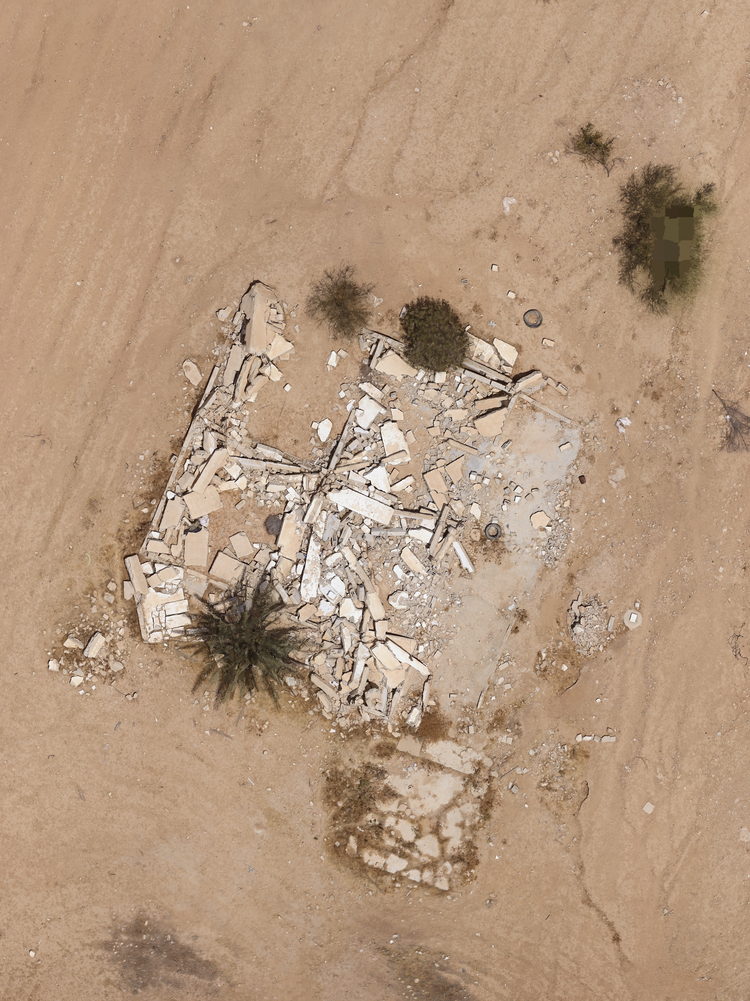
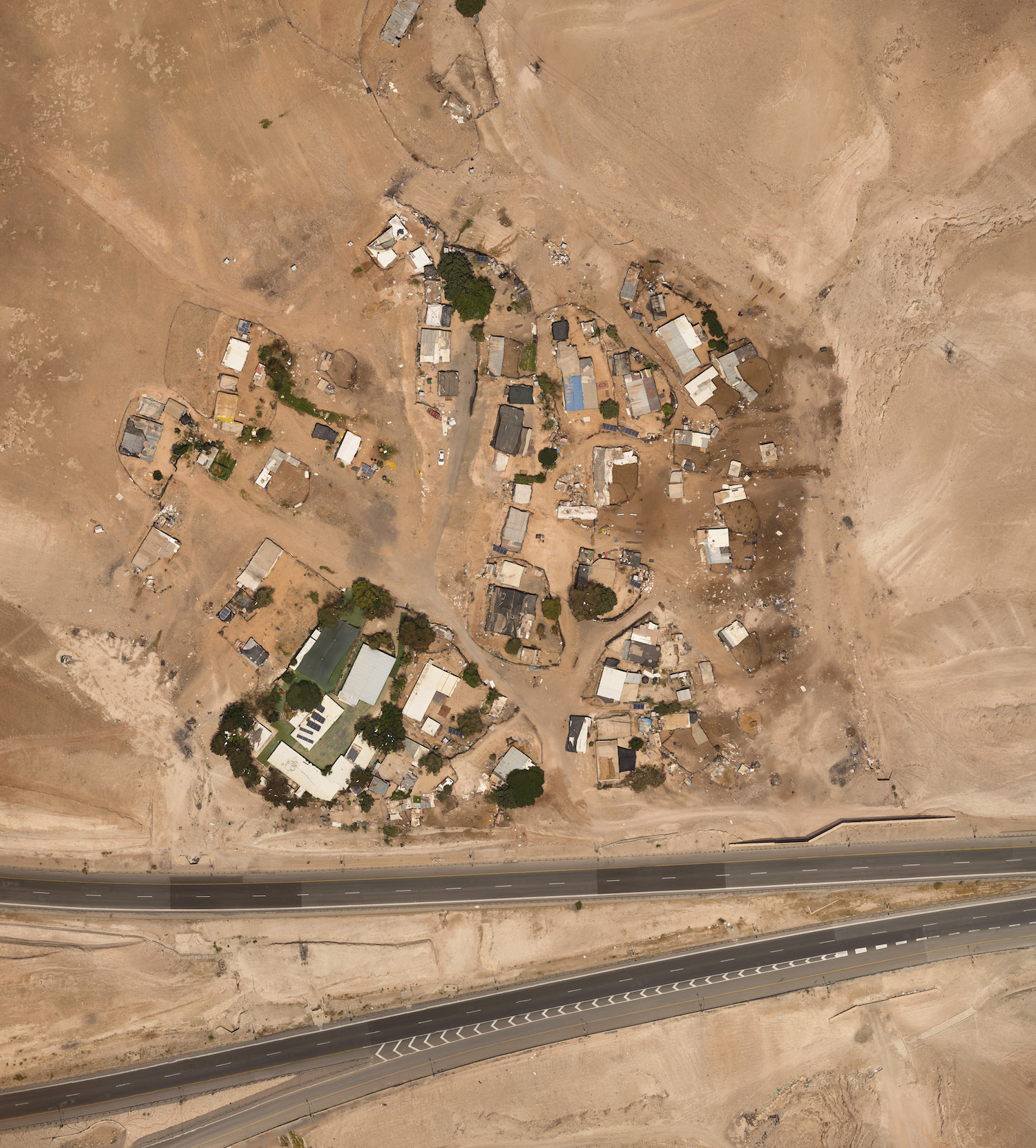
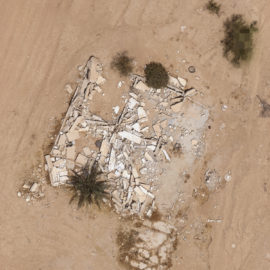
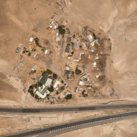
Al-Jammama, Position: 31°29’51"N 34°41’7"E, Altitude: 164.2 m, Timestamp: 17.12.2018 – 13:27.
Source:
In 1997, an amendment to the US National Defense Authorization Act barred American corporations from distributing high-resolution satellite images of Israel and the occupied Palestinian territories. Citing Israeli security concerns, this amendment forced American mapping services like Google Earth to impose scale restrictions on their images of the region, limiting what its users can see.
Israeli photographers Miki Kratsman and Shabtai Pinchevsky’s joint project Anti-Mapping counters this obfuscation by providing high-resolution, alternative maps that expose hidden, demolished, and forgotten parts of the Israeli-Palestinian landscape. “The essence of Anti-Mapping,” explains Kratsman, “is to create a civilian map outside the establishment”.
After collecting thousands of drone shots of each site, Kratsman and Pinchevsky used a mapping and measuring technique called photogrammetry to create 3D models which they then photographed in high-res. As Pinchevsky explains: “We want the satellite image, but we don’t have a satellite. So we’re kind of creating it.”

In Kratsman and Pinchevsky’s images of Israel-Palestine, currently on display at the Tel Aviv Museum of Art, the landscape is depicted in around 100 times more detail than images of the region obtained through Google Earth. These photographs restore details that have disappeared from official maps: Palestinian villages destroyed in 1948, the year Israel declared statehood; villages belonging to nomadic Arab Bedouin tribes, unrecognised by the state; and the Green Line, the 1949 armistice line set out after the 1948 Arab–Israeli War. “The places that we chose to map are all connected to the history of forced displacement in Israel and Palestine,” explains Pinchevsky.
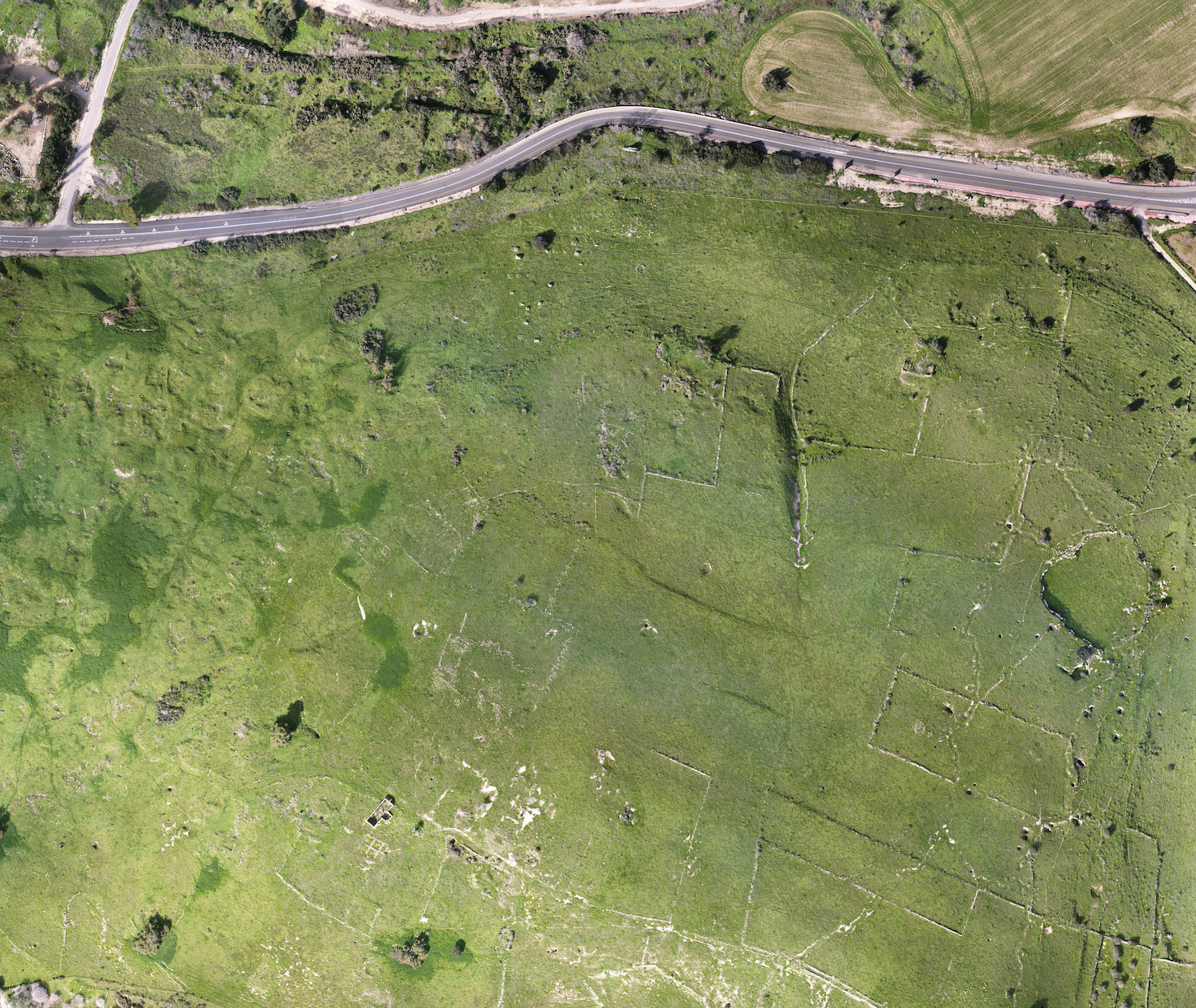
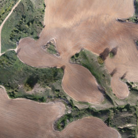
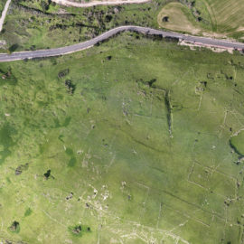
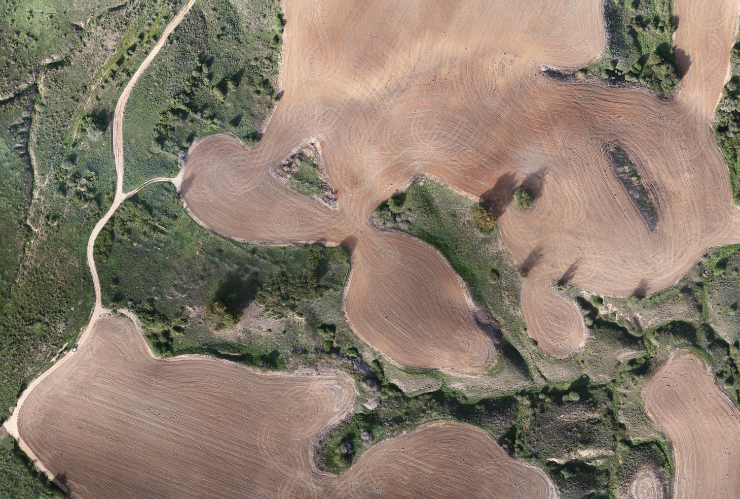
Their images of al-Jammama, a former Palestinian village in Israel’s Negev desert, show the ploughed agricultural fields of Kibbutz Ruhama, the Israeli community which lives there now. Around these brown fields are untended swaths of green: untouched parts of the former village. “You have two layers here,” explains Kratsman, “The green is 1948. And the brown is now.”

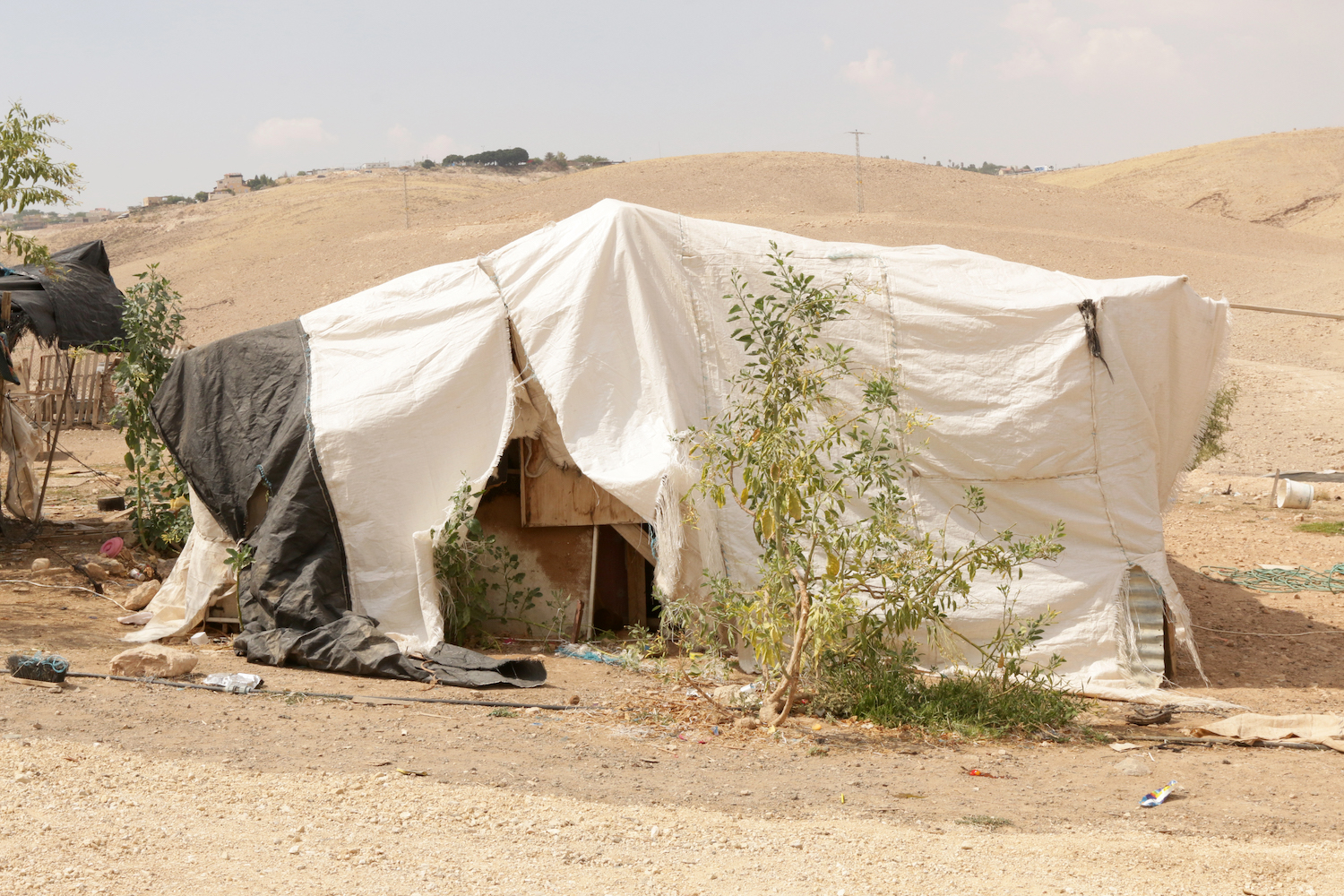
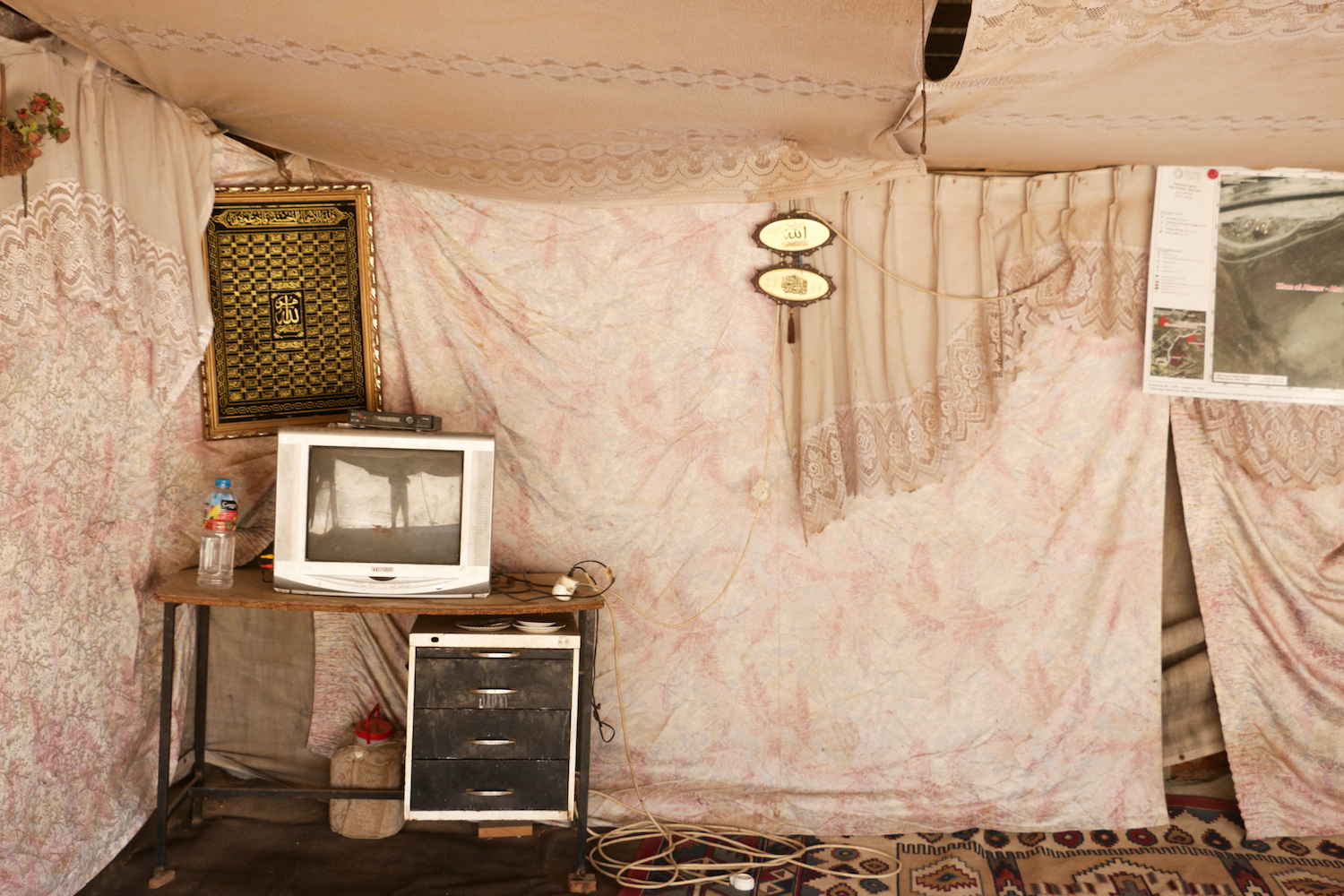
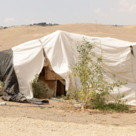
The artists supplement their aerial images with close-up shots of conditions on the ground. In one photograph of Umm al-Hiran [above], an unrecognised Bedouin village, a tree sprouts from the ruins of a demolished house. “The tree became a kind of monument for the house that was there before. Because we are allowed to destroy the house but not the tree,” Kratsman says.
Each image title includes the site’s coordinates and altitude, as well as a timestamp. These details function as another kind of map: one for visitors to track how places have changed over time. “We go to document places that are under the threat of displacement and we know that if we go back there in a few years, it will look different,” explains Pinchevsky.
Anti-Mapping asserts a fundamental human “right to see” that transcends the will of any government, corporation, or establishment. Kratsman and Pinchvesky are working to preserve this right by building a high-resolution archive of the fluctuating Israeli-Palestinian landscape. Their project is at once a revelation of the past, a record of the present, and a resource for the future. As Kratsman explains, “It’s only the starting point, the hook to talk about the place we live in.”
Anti-Mapping is on display at the Tel Aviv Museum of Art until 25 November 2021.